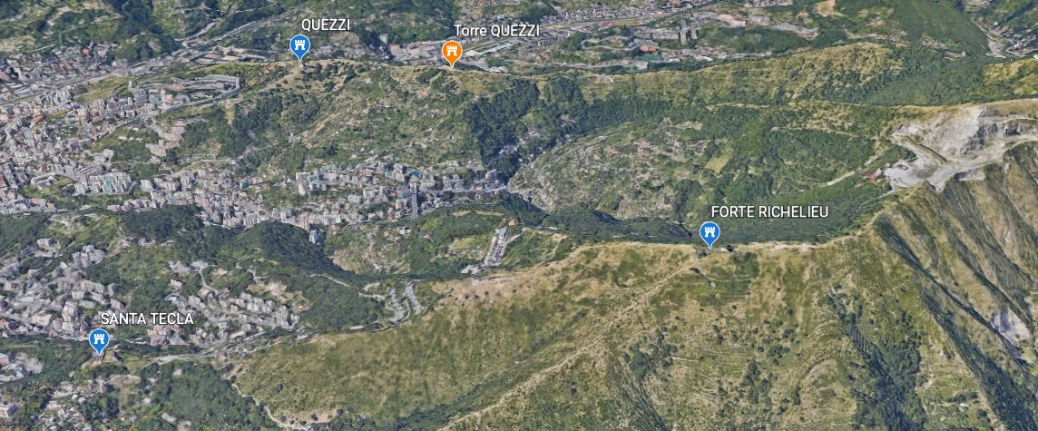
Forte Richelieu

Posto sul contrafforte orientale del Ratti è situato a 415 metri sul livello del mare. Si erge sopra l’abitato dei Camaldoli e lo si può raggiungere a piedi pochi minuti dopo aver lasciato il capolinea dell’autobus e  percorrendo la strada che conduce alla cava del monte Ratti. Altro itinerario si può seguire intraprendendo da S. Martino la ripida salita S. Tecla e via Camaldoli.
L’ultimo tragitto alternativo è il più impervio: da Borgoratti si risale via Copernico; lasciata la carrozzabile alla sua estremità superiore si prosegue per un sentiero, lungo il crinale incontriamo presso un serbatoio dell’acquedotto alcuni fossati e trincee del 1747, proseguiamo a vista sino a raggiungere il forte in un’ora circa.
Il Duca Richelieu giunto a Genova nel settembre 1747, osservando le difese nei dintorni della città, consiglia al Magistrato delle Fortificazioni di munire con opere difensive il colle sopra i Camaldoli.
Il Sicre su questa richiesta prepara un progetto di un fortilizio a forma allungata, bello nella pulizia delle linee e nella razionalità delle difese. È la tipica ridotta settecentesca, bassa sul terreno e robusta. Nel novembre del 1747 i lavori sono iniziati, e nel breve giro di sette mesi è completato nel fossato, nei basamenti dei muraglioni e nel terrapieno per l’artiglieria. Il caposaldo fu intitolato al vanaglorioso Richelieu.
Nel febbraio del 1748 il forte è in condizioni di difendersi, ma i muraglioni sono ancora in pietre a secco. Nel maggio 1748 il Maresciallo di Campo Chauvelin chiede di fornirlo d’artiglieria, di costruire una cisterna, predisporre alloggiamenti per almeno 150 soldati, i magazzini, innalzare una palizzata intorno al fossato,
e costruire due piloni al centro della cortina al lato mare per poter gettare il ponte levatoio. Per far tutto ciò occorrerebbero almeno 400 operai. Il numero spropositato dei lavoratori ci fa capire l’urgenza di completare l’opera, dettata dal timore di un’iniziativa austriaca su Genova.
Infatti all’approssimarsi della data stabilita per por fine alle ostilità i contendenti avrebbero cercato di farsi trovare in posizione di reciproco vantaggio per stabilire più favorevoli condizioni di pace.
Dopo il 1748 il forte fu abbandonato ma troverà onore nel 1800.

Migliorie furono apportate dal Genio Militare Sardo tra il 1815 e il 1827; da un progetto del 1850 si può osservare lo stato del forte, e le proposte di successive modifiche. Osserviamo che rispetto al progetto del 1747 era stato rettificato il lato Genova; allargato il corpo centrale spostando a valle il muro lato Sturla; modificata la parte a monte aggiungendo un bastione e ricavando così l’apertura di una nuova troniera. Il prospetto a mare era variato con la riduzione dei bastioni a tutto vantaggio della cortina. Davanti al ponte levatoio era un piccolo piazzale, con un vallo di prima difesa dalla caratteristica forma a freccia, e collegato al cammino coperto. L’altezza dei muri è notevole, sono mediamente 10 metri dal parapetto alla base. Al centro del recinto si ergeva una casermetta rettangolare di metri 8×13 alta circa 7 metri, per l’alloggiamento truppa, altre due baracche erano dietro la torre.
Un nuovo progetto del 1850 prevedeva sugli spalti altre tre troniere puntate a monte, la formazione dietro la cortina di corpi di guardia con feritoie e troniere prospicenti il fossato, la sistemazione della polveriera nel bastione a levante, il porticato ed una caserma su due piani.
La copertura della caserma, nell’elaborato del 1850 era proposta con spesse volte più un riporto di terra per attutire l’impatto delle bombe. Tale soluzione richiedeva ai piani sottostanti spesse strutture verticali; si preferirà optare per una copertura con volte più sottili a tutto vantaggio dell’abitabilità interna, tanto più che l’avvento dell’artiglieria a canna rigata avrebbe vanificato le difese riposte nello spessore delle murature.
Dal cortile posteriore un passaggio sotterraneo doveva condurre ad una torre, poi non attuata, e ad un camminamento interrato per i fucilieri nel muraglione di controscarpa a nord.
Al posto della torre fu attuata un’appendice sporgente al centro dei due bastioni e munita di feritoie a livello fossato.
Una successiva modifica che valse a conferirgli un aspetto inconsueto, quasi rinascimentale, fu la copertura a falde impostata sui baluardi e sulla cortina del fronte mare e sulla caserma; a tale scopo si costruirono lungo i parapetti dei pilastri in muratura per sostenere le capriate.
Durante l’ultima guerra fu utilizzato come appoggio alle batterie antiaeree situate un centinaio di metri a nord.
Lo stato di abbandono attuale è simile a quello degli altri forti; la struttura è sostanzialmente integra, sono per lo più le parti esterne che lentamente si sgretolano per incuria ed insensibilità.
Attualmente è in uso alla RAI che vi ha montato un ripetitore, per cui il forte non è visitabile.

(Tratto da “Fortificazioni campali e permanenti di Genova” di R. Finocchio, Valentini Editore)

Batterie nei pressi del Forte Richelieu

Mappa Forte Richelieu
planimetria forte richelieu

(Tratto da “I forti di Genova” Sagep Editice)

Situated on the eastern buttress of the Ratti is located at 415 meters above sea level. It rises above the town of Camaldoli and can be reached on foot a few minutes after leaving the bus terminus and following the road that leads to the quarry of Mount Ratti. Another itinerary can be followed by taking the steep climb from S. Martino to S. Tecla and via Camaldoli.
The last alternative route is the most impervious: from Borgoratti we go up via Copernico; leaving the carriage road at its upper end, we continue along a path, along the ridge we find some ditches and trenches dating back to 1747 near an aqueduct reservoir, we continue by sight until we reach the fort in about an hour.
The Duke Richelieu arrived in Genoa in September 1747, observing the defenses around the city, advised the Magistrate of Fortifications to equip with defensive works the hill above the Camaldoli.
Sicre based on this request prepared a project for an elongated fortress, beautiful in the clean lines and rationality of the defenses. It is the typical eighteenth-century redoubt, low on the ground and strong. In November 1747 the works began, and in the short span of seven months it was completed in the moat, in the basement of the walls and in the embankment for the artillery. The stronghold was named after the vaunted Richelieu.
In February 1748 the fort is in a condition to defend itself, but the ramparts are still in dry stone. In May 1748 Field Marshal Chauvelin asked to provide it with artillery, to build a cistern, to provide accommodation for at least 150 soldiers, warehouses, to raise a palisade around the moat, and build two pylons in the middle of the curtain wall on the sea side in order to build the drawbridge. To do all this would require at least 400 workers. The disproportionate number of workers makes us understand the urgency to complete the work, dictated by the fear of an Austrian initiative on Genoa.
In fact, at the approach of the date established to put an end to the hostilities, the contenders would have tried to be found in a position of mutual advantage to establish more favorable conditions of peace.
After 1748 the fort was abandoned but will find honor in 1800.

Improvements were made by the Sardinian Military Engineers between 1815 and 1827; from a project of 1850 we can observe the state of the fort, and the proposals for subsequent changes. Compared to the project of 1747, the Genoa side was corrected; the central body was enlarged by moving the wall on the Sturla side downstream; the upstream part was modified by adding a new wall.
The upstream part was modified by adding a bastion and thus obtaining the opening of a new trunk. The prospectus to the sea was varied with the reduction of the ramparts to the advantage of the curtain. In front of the drawbridge was a small square, with a wall of first defense from the characteristic shape of an arrow, and connected to the covered walk. The height of the walls is remarkable, they are on average 10 meters from the parapet to the base. At the center of the fence stood a rectangular barracks of 8×13 meters high about 7 meters, for housing troops, two other barracks were behind the tower.
A new project of 1850 provided on the terraces other three thrones pointed upstream, the formation behind the curtain of guards with loopholes and thrones overlooking the moat, the arrangement of the powder magazine in the rampart to the east, the arcade and a barracks on two floors.
The coverage of the barracks, in the draft of 1850 was proposed with thick vaults plus a layer of earth to cushion the impact of the bombs. This solution required thick vertical structures on the floors below; it will be preferred to opt for a cover with thinner vaults to the advantage of internal habitability, especially since the advent of artillery rifled barrel would have frustrated the defenses placed in the thickness of the walls.
From the rear courtyard, an underground passageway was supposed to lead to a tower, which was not built, and to an underground walkway for the riflemen in the counterscarp wall to the north.
The tower was replaced by an appendage projecting at the center of the two bastions and equipped with loopholes at moat level.
A subsequent modification that gave it an unusual appearance, almost renaissance, was the pitched roof set on the ramparts and on the curtain of the sea front and on the barracks; to this end, masonry pillars were built along the parapets to support the trusses.
During the last war it was used as support for the anti-aircraft batteries located a hundred meters to the north.
The current state of abandonment is similar to that of other forts, the structure is essentially intact, are mostly the external parts that slowly crumble due to neglect and insensitivity.
Currently it is used by RAI that has mounted a repeater, so the fort is not visitable.